
Daytonology Two Year Anniversary
Back in January there was this post, announcing yer humble hosts impending departure from Dayton and the closure of this blog.
The move is on hiatus due to the dire job situation but the blog is done. Daytonology has been running on empty for quite a while now, so this two year anniversary (the first posts were during July 2007) is as good a time as any to close the blog. Two to three years is the average life span of a blog, too.
Since there are things linking here the blog will be online for a few more months. This will give people who surf in time to remove links if they have any (if other bloggers are like me they periodically check their link roll and cull dead links).
Come December the delete button will be pushed and this blog will finally disappear into the ether.
Sunday, July 19, 2009
The Space Race is Over
Since this is the 40th anniversary of the first men on the moon, a good song on the subject, sort of, by UK folk-rocker Billy Bragg. Bragg was a fan of Simon and Garfunkle as a teen before going through the "cleansing fire of punk" (as he says) and one can tell the influence of a certain Paul Simon song here. In fact Bragg cribbed a line from it for this lyric. Y'all can guess that song.
Anyway, a good song from one of Billy Braggs best albums:
The Space Race is Over
Anyway, a good song from one of Billy Braggs best albums:
The Space Race is Over
When I was young I told my mum
I'm going to walk on the Moon someday
Armstrong and Aldrin spoke to me
From Houston and Cape Kennedy
And I watched the Eagle landing
On a night when the Moon was full
And as it tugged at the tides, I knew deep inside
I too could feel its pull
I lay in my bed and dreamed I walked
On the Sea of Tranquillity
I knew that someday soon we'd all sail to the moon
On the high tide of technology
But the dreams have all been taken
And the window seats taken too
And 2001 has almost come and gone
What am I supposed to do?
Now that the space race is over
It's been and it's gone and I'll never get to the moon
Because the space race is over
And I can't help but feel we've all grown up too soon
Now my dreams have all been shattered
And my wings are tattered too
And I can still fly but not half as high
As once I wanted to
Now that the space race is over
It's been and it's gone and I'll never get to the moon
Because the space race is over
And I can't help but feel we've all grown up too soon
My son and I stand beneath the great night sky
And gaze up in wonder
I tell him the tale of Apollo And he says
"Why did they ever go?"
It may look like some empty gesture
To go all that way just to come back
But don't offer me a place out in cyberspace
Cos where in the hell's that at?
Now that the space race is over
It's been and it's gone and I'll never get out of my room
Because the space race is over
And I can't help but feel we're all just going nowhere
Urban Bohemia and Left Wing Political Style
Stadt luft macht frei, City air makes one free.
This old German saying, perhaps coming from the Middle Ages or Renaissance, could be the theme of a cultural tendancy of modern America, too, as it is so contrary to the American ethos, which is, at heart, anti-urban. As we here in the Dayton region know all too well.
That cultural tendancy is for cultural and political free thinkers and innovators to seek out the city as a favorable mileau for innovation, leading to the formation of urban bohemia, but also the ongoing connection of this bohemia to a left politlcal turn, meaning either revolution or reform, either socialist or anarchist.
This phenomenon was perhaps already visible at the dawn of Bohemia, in 19th century Paris.
Bohemia & The Paris Commune
Bohemia was first named by Henry Murger, staging a play on Bohemia in 1849 and later publishing Scenes de la Vie de Boheme in 1851, just after the 1848 revolution, the one that overthrew Louis Phillipe. It's unclear what role Murgers bohemians played in that revolution. In fact it appears that Bohemia was pretty much apolitical at first. Yet it's certain members of the bohemian subculture participated in the great proleterian insurrection of 1871, the Paris Commune.

Perhaps that is a bohemian in the red coat, on the right of the above illustration of the Communards marching with Marianne, symbol of the French Revolution. Both literary figures of Parisian bohemia and at least one artist, Gustave Courbet, participated in the Paris Commune.
And this wasn't "left wing political" style, as over 20,000 died or were executed, with even more deported the colony of New Caledonia. Observers hostile to the Commune noted that it was "the death of Bohemia".
Another time and place where urban bohemia (and when isn't it urban?) intersected with politics, or at least social criticsm, was in Berlin, perhaps during the Wilhelmine era but certainly after 1918 with the coming of the Weimar Republic. This was most clearly seen with Berlin manifestation of the Dada movement. Dada was essentially apolitical in its original form in Zurich, but took a decidely left wing turn in Berlin, with artists such as the painter/illustrator Georg Grosz and collagist John Heartfield creating bitter, politcally charged artworks. It must be said that Grosz himself was no follower of any political line, distrusting ideology and political supermen, as he makes clear in his excellent autobiography: Ein klienes Ja und ein grosses Nein (A small Yes and a big No)
The Political Turn in American Bohemia
The first urban bohemia in the United States was probably Greenwich Village, which became a location for artists and writers in the early 20th century (perhaps earlier?). The development of the Village as an artists enclave parallelled the great "second immigration" to America from eastern and southern Europe and the second wave industrialization.
Artists of this era documented and even celebrated this booming urban world, especially artists of the "Ash Can School". One of these was John Sloan, one of the great painters of the American city, as demonstrated by this wonderful painting of a part of New York.
 Greenwich Village was also a center of political and social creativity. An example of this was The Masses, a magazine put out by the Village creative class. In the example below the same John Sloan who did the above painting provided this cover on the miners strike in Ludlow, Colorado (later immortalized in the Woody Guthrie song "The Ludlow Massacre").
 The Village tradition of politically committed artists, writers, and illustrators lived on into our times. A good example is World War 3 Illustrated, a collection of comix and illustrations put out by people associated with the East Village scene, such as Eric Drooker and Peter Kuper, The East Village was a modern geographical and cultural expansion of the old Greenwich Village of The Masses and Ashcan School.
 This same East Village scene was the setting for the popular musical Rent.
One doesn't usually associate musicals with either bohemia or political content, but Rent is perhaps the exception. The story of Rents relation to 19th century Paris via Puccini is probably known to readers thus need not be detailed here. What is probably not known is that the writer/composer Jonathan Larson was himself quite political, having developed an earlier musical on the right wing ascendence in 1980s America. And Larson pretty much lived the bohemian life of little money and day jobs, concentrating on his art.
And of course there is that theme of AIDS running through the musical. In fact one thing that made Rent radical was it's putting of gay and lesbian relationships on equal footing as straight ones.
Urban bohemia had long provided cover for sexual innovators and non-standard relationships, so became a tolerant mileau for gays and lebsians. One of the sources of modern gay rights movmenet came out of the Greenwich Village bohemia, the explicitly political Gay Liberation Movement.
Art and politics were to cross again with the advent of AIDS and the hostile social and political climate the disease engendered. One response was via the work of artists like Keith Haring, part of the street art scene, and the edgier David Wojnarowicz, who went beyond art and fought legal battles in the culture war against the right wing.
 Haring was already well known in art circles for his graffitti-inspired work when he joined the new ACT-UP movement. ACT UP is a good example of the politicl potential of a radicalized creative class. In this case it was not just artists but individuals involved in commercial art, the adverstising industry, who developed a potent visual identity for the movement, which was innovative in agit-prop tactics, civil disobedience, and media manipulation.
 This continued on into non-gay alternative politics, probably best known via the anti-globalization demonstrations in Seattle, but also via the Indymedia/Infoshop movement, which is probably more anarchist than left (if one had to put a label on all this).
 New York has been mentioned a lot. But urban bohemias exist outside of NYC. Particularly on the West Coast, but also here in the Midwest, in Chicago.
Chicago had it's own Greenwich Village in Tower Town, the neighborhood directly west of the old Water Tower, around Bughouse Square (traditionally the Speakers Corner of Chicago), an intersection of the political, literary, and artistic (as can be seen by this collection on Chicago's free speech tradition. Frequently seen in that collection is the Dill Pickle Club, which rang the same politico-cultural changes as Greenwich Village.
Chicagos politicized bohemian spirit continues one in modern things, like some of the plays of Theatre Oobleck. And some of the newer neighborhoods, which are described as "hipster" but also have a certain political turn, as one can see by these pix of a mural on various freedom fighters, in the traditional colors of anarchy and revolution, red and black.
The Mexican revolutionary Zapata
 Bob Marley and some woman who I don't recognize.

An odd juxtaposition, Ghandi and Che Guevera. Could they be any more different in style?

Dayton Bohemia and Left Wing Political Style
Yer humble host wouldn't know because, though a longtime lefty in spirit, he's not part of the local bohemia. Since the scene here is more music based one won't see (or hear) much politics because, unlike in Europe, the US alt/indy scene isn't that political. Yes, the left does have the best music, but its usually the British left.
Locally, if there is a political turn it's more of a libertarian one, or indifference to politics (which is the usual image of the bohemian, someone who lives for art)
About the only local artist that works political content into his work is Drexel Dave Sparks, though he's probably more a libertarian than a lefty (based on his previous incarnations online as Sparkdog, host of the late, lamented Fat City News). An example of DD's political content; bedpan commentary on Bob Taft:

I recall one other local visual artist (whos name escapes me, but I do know he is an Iraq veteran) who's done some interesting things on the Iraq War and related themes. And there is a fellow associated with The Circus who does rap/spoken word with some proto-political content..more about social conditions...which have political implications.
And that's about it for Dayton. Which brings up the the fact that this political turn in urban bohemia is probably found only certain large cities. Yet it neglected aspect of the creative class concept, which tends to depoliticize the cultural creative scene, rather than recognize a bohemian tendancy to political radicalism, or, at very least, political critique.
This old German saying, perhaps coming from the Middle Ages or Renaissance, could be the theme of a cultural tendancy of modern America, too, as it is so contrary to the American ethos, which is, at heart, anti-urban. As we here in the Dayton region know all too well.
That cultural tendancy is for cultural and political free thinkers and innovators to seek out the city as a favorable mileau for innovation, leading to the formation of urban bohemia, but also the ongoing connection of this bohemia to a left politlcal turn, meaning either revolution or reform, either socialist or anarchist.
This phenomenon was perhaps already visible at the dawn of Bohemia, in 19th century Paris.
Bohemia & The Paris Commune
Bohemia was first named by Henry Murger, staging a play on Bohemia in 1849 and later publishing Scenes de la Vie de Boheme in 1851, just after the 1848 revolution, the one that overthrew Louis Phillipe. It's unclear what role Murgers bohemians played in that revolution. In fact it appears that Bohemia was pretty much apolitical at first. Yet it's certain members of the bohemian subculture participated in the great proleterian insurrection of 1871, the Paris Commune.

Perhaps that is a bohemian in the red coat, on the right of the above illustration of the Communards marching with Marianne, symbol of the French Revolution. Both literary figures of Parisian bohemia and at least one artist, Gustave Courbet, participated in the Paris Commune.
And this wasn't "left wing political" style, as over 20,000 died or were executed, with even more deported the colony of New Caledonia. Observers hostile to the Commune noted that it was "the death of Bohemia".
Another time and place where urban bohemia (and when isn't it urban?) intersected with politics, or at least social criticsm, was in Berlin, perhaps during the Wilhelmine era but certainly after 1918 with the coming of the Weimar Republic. This was most clearly seen with Berlin manifestation of the Dada movement. Dada was essentially apolitical in its original form in Zurich, but took a decidely left wing turn in Berlin, with artists such as the painter/illustrator Georg Grosz and collagist John Heartfield creating bitter, politcally charged artworks. It must be said that Grosz himself was no follower of any political line, distrusting ideology and political supermen, as he makes clear in his excellent autobiography: Ein klienes Ja und ein grosses Nein (A small Yes and a big No)
The Political Turn in American Bohemia
The first urban bohemia in the United States was probably Greenwich Village, which became a location for artists and writers in the early 20th century (perhaps earlier?). The development of the Village as an artists enclave parallelled the great "second immigration" to America from eastern and southern Europe and the second wave industrialization.
Artists of this era documented and even celebrated this booming urban world, especially artists of the "Ash Can School". One of these was John Sloan, one of the great painters of the American city, as demonstrated by this wonderful painting of a part of New York.
 Greenwich Village was also a center of political and social creativity. An example of this was The Masses, a magazine put out by the Village creative class. In the example below the same John Sloan who did the above painting provided this cover on the miners strike in Ludlow, Colorado (later immortalized in the Woody Guthrie song "The Ludlow Massacre").
 The Village tradition of politically committed artists, writers, and illustrators lived on into our times. A good example is World War 3 Illustrated, a collection of comix and illustrations put out by people associated with the East Village scene, such as Eric Drooker and Peter Kuper, The East Village was a modern geographical and cultural expansion of the old Greenwich Village of The Masses and Ashcan School.
 This same East Village scene was the setting for the popular musical Rent.
One doesn't usually associate musicals with either bohemia or political content, but Rent is perhaps the exception. The story of Rents relation to 19th century Paris via Puccini is probably known to readers thus need not be detailed here. What is probably not known is that the writer/composer Jonathan Larson was himself quite political, having developed an earlier musical on the right wing ascendence in 1980s America. And Larson pretty much lived the bohemian life of little money and day jobs, concentrating on his art.
And of course there is that theme of AIDS running through the musical. In fact one thing that made Rent radical was it's putting of gay and lesbian relationships on equal footing as straight ones.
Urban bohemia had long provided cover for sexual innovators and non-standard relationships, so became a tolerant mileau for gays and lebsians. One of the sources of modern gay rights movmenet came out of the Greenwich Village bohemia, the explicitly political Gay Liberation Movement.
Art and politics were to cross again with the advent of AIDS and the hostile social and political climate the disease engendered. One response was via the work of artists like Keith Haring, part of the street art scene, and the edgier David Wojnarowicz, who went beyond art and fought legal battles in the culture war against the right wing.
 Haring was already well known in art circles for his graffitti-inspired work when he joined the new ACT-UP movement. ACT UP is a good example of the politicl potential of a radicalized creative class. In this case it was not just artists but individuals involved in commercial art, the adverstising industry, who developed a potent visual identity for the movement, which was innovative in agit-prop tactics, civil disobedience, and media manipulation.
 This continued on into non-gay alternative politics, probably best known via the anti-globalization demonstrations in Seattle, but also via the Indymedia/Infoshop movement, which is probably more anarchist than left (if one had to put a label on all this).
 New York has been mentioned a lot. But urban bohemias exist outside of NYC. Particularly on the West Coast, but also here in the Midwest, in Chicago.
Chicago had it's own Greenwich Village in Tower Town, the neighborhood directly west of the old Water Tower, around Bughouse Square (traditionally the Speakers Corner of Chicago), an intersection of the political, literary, and artistic (as can be seen by this collection on Chicago's free speech tradition. Frequently seen in that collection is the Dill Pickle Club, which rang the same politico-cultural changes as Greenwich Village.
Chicagos politicized bohemian spirit continues one in modern things, like some of the plays of Theatre Oobleck. And some of the newer neighborhoods, which are described as "hipster" but also have a certain political turn, as one can see by these pix of a mural on various freedom fighters, in the traditional colors of anarchy and revolution, red and black.
The Mexican revolutionary Zapata
 Bob Marley and some woman who I don't recognize.
An odd juxtaposition, Ghandi and Che Guevera. Could they be any more different in style?

Dayton Bohemia and Left Wing Political Style
Yer humble host wouldn't know because, though a longtime lefty in spirit, he's not part of the local bohemia. Since the scene here is more music based one won't see (or hear) much politics because, unlike in Europe, the US alt/indy scene isn't that political. Yes, the left does have the best music, but its usually the British left.
Locally, if there is a political turn it's more of a libertarian one, or indifference to politics (which is the usual image of the bohemian, someone who lives for art)
About the only local artist that works political content into his work is Drexel Dave Sparks, though he's probably more a libertarian than a lefty (based on his previous incarnations online as Sparkdog, host of the late, lamented Fat City News). An example of DD's political content; bedpan commentary on Bob Taft:

I recall one other local visual artist (whos name escapes me, but I do know he is an Iraq veteran) who's done some interesting things on the Iraq War and related themes. And there is a fellow associated with The Circus who does rap/spoken word with some proto-political content..more about social conditions...which have political implications.
And that's about it for Dayton. Which brings up the the fact that this political turn in urban bohemia is probably found only certain large cities. Yet it neglected aspect of the creative class concept, which tends to depoliticize the cultural creative scene, rather than recognize a bohemian tendancy to political radicalism, or, at very least, political critique.
Mock Turtle Press
More signs of life in the dying city.
Stopping by Jazzy Java Cafe I happened across a basket of little chapbooks with a donation can. Entitled "Collage" this is a collection of stories. The one bought was "short stories by Dayton authors". So it seems people are still doing zines here.
The publisher is "Mock Turtle Press", who maintains both a facebook and myspace page. Here's a link to the hipper myspace site (and, as is usual, the "Freinds" section provides linkage to local cultural creatives and their freinds and associates).
Perhaps what's interesting here is the concept of mixing print & paper (zines) with a presence in the social networking online world. The myspace/facebook sites promotes the zine, but one wonders if a zine could work the other way, promoting a blog or online place.
Stuff like this is heartening; small shoots of independent cultural production in a desert of soul sucking cultural conformity and conservativism. It's the small thrills of looking at the little postcards and mini-flyers at, say, Gem City or Jazzy Java or that coffeeshop at Paccia, or at the 5th Street Deli (and the larger band and event posters in the windows); that there are things happening out there, a scene of sorts creating and producing things, usually music but other types of cultural activity, too.
In short, a local bohemia or alternative scene.
Perhaps Dayton could evolve something like the Bristol Underground Scene. Or maybe it already has and all is needed is a wikipedia entry?
The Dayton Daily News Beats the Creative Class Drum
Daytonology has done some desultory blogging about Richard Florida's Creative Class concept and the local attempt at doing Creative Class things, the Dayton Create initiative.
But not too much because yer humble host isn't part of this class, or category. Not because of cynicsm since Florida is on to something (albeit something difficult to measure).
What's good to see is the Dayton Daily News continuing to report on the progress and the positive editorials on the intiatives. Recently there was one on UpDayton, the young adult group, who have been quite active: Creative Class Living Is Up to Name
The article mentions the "summit" sponsored by UpDayton, which came in for quite a bit of critique from the local blogosphere (Daytonology Included):
One group organized a summit last spring where two hundred or so people showed up to mull over what to do first. What could have been a boring, discouraging gripe fest was a mass brainstorming session that wrapped up with participants settling on four big things to tackle.
...oddly enough the DDN itself is the source of the regions' largest ongoing "boring, discouraging gripe fest"; the readers comments to their local news articles, especially ones dealing with urban affairs.
I guess this editorial signals that the editors do not share the views of their more vocal readers.
The editorial discussed UpDayton's "Don't Dog Dayton" video contest, which is one of three things they are pushing for in their Grow Downtown intiative. Another is revitalize existing festivals, which are, presumably, not attractive to the 20 and 30 - somethings (one of the local bloggers has noted the festivals decline, so a definite issue here).
It will be easy for UpDayton and the other DaytonCreate initiatives to get lost in the generalized malaise and negativity, the black hole of bad local karma, so a big pat on the back for the DDN for keeping this (admittedly small) counter-trend in public view via their editorials.
Saturday, July 18, 2009
Building Xenia Junction.
Xenia developed into one of Ohio’s railroad towns, a species of place that had some importance to railroading due to repair facilities and as a junction point for the railroads that criss-crossed Ohio during this era.
On the map this looks quite confusing, so this post will attempt to untangle the knot of railroads via a chronology.
The story starts with a pioneer railroad, one of the very first in the state. The Little Miami Railroad reached Xenia in 1845, five or six years before Dayton received it’s first railroad. The early lines didn’t have powerful engines, so grade was a consideration. One can see this in the Little Miami right-of-way; The Little Miami took a valley route into Xenia, departing the Little Miami bottomlands at Spring Valley and following the valley of Gladys Run into town:
 The Little Miami Railroad, entered town on the exceptionally wide Detroit Street (on the east side of the street), which was a bit unusual for Ohio (there are at least two examples of this in Kentucky, in Frankfort and Lagrange).
Xenia railroad lore says that a promoter donated a building on Detroit Street as a station, with the proviso that trains would stop there for all time. And apparently passenger trains did continue to stop there after the union station was built in the 1850s.
Next a few diagrams showing the evolution of the junction.
Xenia, starting with the Little Miami.
 In the mid 1840s Columbus had no railroads, so a daily line of mail stages went into operation between the railhead at Xenia and Columbus and Dayton.
The next year the line was extended to Springfield. The original route was to be via Clifton and it’s big mill, but the promoters of Yellow Springs offered money to route the line through that town. The route via a mill might have been because the railroad was initially conceived, in part, to provide an outlet for the merchant millers of the Little Miami valley.

At Springfield one took a stage to make the connection with the Mad River Railroad railhead at Bellefontaine. There was also a line of “daylight stages” to connect with Columbus, perhaps via the National Road. The journey from Cincinnati via Xenia, Springfield, stage coach to Bellefontaine, overnight in Bellefontaine, then on to the lake port of Sandusky took around 27 hours in 1847.
The next line was the Columbus and Xenia, which presumably replaced the stage to Columbus.
 This line would eventually connect with the Columbus and Cleveland railroad, and ultimately to the eastern seaboard via the Lake Shore Railroad east from Cleveland, becoming a main line into Cincinnati, relegating the old Little Miami north of Xenia to branch line status.
The C & X entered Xenia via the valley of one the forks of Shawnee Creek, joining the Little Miami in the valley just south of the forks of Shawnee. The Xenia junction was starting to form
The Columbus and Xenia had originally projected to connect to Dayton. Instead, a railroad was projected east from Dayton. This was the Dayton, Xenia and Belpre.

The DX&B was intended as a “resource road”, connecting the Hanging Rock Iron region (and early coal fields) to Dayton manufacturers, and also offering a connection to tidewater via the Baltimore and Ohio branch across the river from Belpre at Parkersburg.
This line was never completed. Grading extended as far as Jamestown and then work ceased.
In the 1870s there was a second attempt at a “coal road”, a narrow gauge line from Dayton to the vicinity of Wellston and Jackson in Appalachian Ohio. Narrow gauge is usually associated with logging and mining railroads out west, but here it was used as a long distance cross-country line.

This line was eventually converted to standard gauge and taken over by the Baltimore & Ohio.
Xenia Junction in Detail
This vignette shows the old 1850s two story union station. Union because it served more than one railroad at the time. These lines soon went under joint operation and eventually merged. Ultimately they were taken over by the great east-west railroads. In this case the Pennsylvania and Baltimore and Ohio.

The junction in the 1870s. One can see the station, a roundhouse, a freight house, and some sidings.
 By the 1890s one sees the Baltimore & Ohio branch swinging into the junction area, with its’ own depot. This is probably a fairly accurate track configuration for that era.

Xenia Junction in the 1930s, from the air. This was the peak of railroading in Xenia, with various shop and support facilities, a small yard, and some sidings. One can see that structures from the 1850s, 70s, and 90s survived into the 1930s. The Greene County historical society has a collection of artifacts, photos, and a scale model of the junction, worth a visit for railfans and history buffs.

The same site today. All the railroads are gone and the junction is now a cycling center, with Xenia Station as a visitors center for bike trails radiating from Xenia on the old railroad right-of-ways.

Another view of the junction. The building is a reconstructed baggage station and railway express office, and has a small exhibit on railroading in Xenia.

And in this aerial one can see how the bike path follows the old Little Miami grade out of the valley to Detroit Street. Some surviving buildings are keyed from old maps to the aerial, showing how some of old Xenia survived into our time (although it should be noted that the station is a reconstruction).

It might be worthwhile taking a closer look at the Sanborn maps to how much of industrial Xenia has survived. Though it had good rail connections Xenia didn’t develop into an industrial center the way nearby Springfield did. And why that was is a good question for econmic history.
Another future post would be to investigate the development of the railroad system in south & west Ohio, since there might be an interesting economic geography story to be told. This would look at the rise of Cincinnati & Dayton as a railroad centers as part of the development of a regional network. Maybe more the subjec of a book or journal article than a blog post, though.
On the map this looks quite confusing, so this post will attempt to untangle the knot of railroads via a chronology.
The story starts with a pioneer railroad, one of the very first in the state. The Little Miami Railroad reached Xenia in 1845, five or six years before Dayton received it’s first railroad. The early lines didn’t have powerful engines, so grade was a consideration. One can see this in the Little Miami right-of-way; The Little Miami took a valley route into Xenia, departing the Little Miami bottomlands at Spring Valley and following the valley of Gladys Run into town:
 The Little Miami Railroad, entered town on the exceptionally wide Detroit Street (on the east side of the street), which was a bit unusual for Ohio (there are at least two examples of this in Kentucky, in Frankfort and Lagrange).
Xenia railroad lore says that a promoter donated a building on Detroit Street as a station, with the proviso that trains would stop there for all time. And apparently passenger trains did continue to stop there after the union station was built in the 1850s.
Next a few diagrams showing the evolution of the junction.
Xenia, starting with the Little Miami.
 In the mid 1840s Columbus had no railroads, so a daily line of mail stages went into operation between the railhead at Xenia and Columbus and Dayton.
The next year the line was extended to Springfield. The original route was to be via Clifton and it’s big mill, but the promoters of Yellow Springs offered money to route the line through that town. The route via a mill might have been because the railroad was initially conceived, in part, to provide an outlet for the merchant millers of the Little Miami valley.

At Springfield one took a stage to make the connection with the Mad River Railroad railhead at Bellefontaine. There was also a line of “daylight stages” to connect with Columbus, perhaps via the National Road. The journey from Cincinnati via Xenia, Springfield, stage coach to Bellefontaine, overnight in Bellefontaine, then on to the lake port of Sandusky took around 27 hours in 1847.
The next line was the Columbus and Xenia, which presumably replaced the stage to Columbus.
 This line would eventually connect with the Columbus and Cleveland railroad, and ultimately to the eastern seaboard via the Lake Shore Railroad east from Cleveland, becoming a main line into Cincinnati, relegating the old Little Miami north of Xenia to branch line status.
 The C & X entered Xenia via the valley of one the forks of Shawnee Creek, joining the Little Miami in the valley just south of the forks of Shawnee. The Xenia junction was starting to form
The Columbus and Xenia had originally projected to connect to Dayton. Instead, a railroad was projected east from Dayton. This was the Dayton, Xenia and Belpre.

The DX&B was intended as a “resource road”, connecting the Hanging Rock Iron region (and early coal fields) to Dayton manufacturers, and also offering a connection to tidewater via the Baltimore and Ohio branch across the river from Belpre at Parkersburg.
This line was never completed. Grading extended as far as Jamestown and then work ceased.
In the 1870s there was a second attempt at a “coal road”, a narrow gauge line from Dayton to the vicinity of Wellston and Jackson in Appalachian Ohio. Narrow gauge is usually associated with logging and mining railroads out west, but here it was used as a long distance cross-country line.

This line was eventually converted to standard gauge and taken over by the Baltimore & Ohio.
Xenia Junction in Detail
This vignette shows the old 1850s two story union station. Union because it served more than one railroad at the time. These lines soon went under joint operation and eventually merged. Ultimately they were taken over by the great east-west railroads. In this case the Pennsylvania and Baltimore and Ohio.

The junction in the 1870s. One can see the station, a roundhouse, a freight house, and some sidings.
 By the 1890s one sees the Baltimore & Ohio branch swinging into the junction area, with its’ own depot. This is probably a fairly accurate track configuration for that era.
Xenia Junction in the 1930s, from the air. This was the peak of railroading in Xenia, with various shop and support facilities, a small yard, and some sidings. One can see that structures from the 1850s, 70s, and 90s survived into the 1930s. The Greene County historical society has a collection of artifacts, photos, and a scale model of the junction, worth a visit for railfans and history buffs.

The same site today. All the railroads are gone and the junction is now a cycling center, with Xenia Station as a visitors center for bike trails radiating from Xenia on the old railroad right-of-ways.

Another view of the junction. The building is a reconstructed baggage station and railway express office, and has a small exhibit on railroading in Xenia.

And in this aerial one can see how the bike path follows the old Little Miami grade out of the valley to Detroit Street. Some surviving buildings are keyed from old maps to the aerial, showing how some of old Xenia survived into our time (although it should be noted that the station is a reconstruction).

It might be worthwhile taking a closer look at the Sanborn maps to how much of industrial Xenia has survived. Though it had good rail connections Xenia didn’t develop into an industrial center the way nearby Springfield did. And why that was is a good question for econmic history.
Another future post would be to investigate the development of the railroad system in south & west Ohio, since there might be an interesting economic geography story to be told. This would look at the rise of Cincinnati & Dayton as a railroad centers as part of the development of a regional network. Maybe more the subjec of a book or journal article than a blog post, though.
Thursday, July 16, 2009
I-75 Interchange Boom: Springboro/Franklin
A first look at two developing interchanges on I-75, building blocks of Daytonnati. These are exits 36 and 38, for State Route 73 and 123, radiating out from Franklin to Springboro and Red Lion.
These exits are developing into substantial business centers, certainly in area or land consumed, if not in actual employment.
 An areil showing development patterns in the vicinity of the interstate. As one can see there is still plenty of open space here.
 But shading the business district, which is mostly industrial or warehouse, not so much retail, the extend of the development becomes quite clear. There is also business activity in "Old Franklin", including at least two legacy industrial facilities from the 19th century, still in operation (Franklin developed as a small industrial center, as did many of the towns on the Great Miami river).
 A close-up of exit 36. This is the "truck stop exit" but behind the big rigs there is a substantial industrial and large-floorplate business presence. This interchange was already under industrial/office development in 1983, so it's taking decades for build-out. It all belongs to Franklin, which apparently has an agressive annexation policy.
 Exit 38 is probably the best known to Daytonians for the Dayton Daily News' new printing plant, but also Buddies Carpet Barn and La Comedia Dinner Theatre. Springboro has annexed the east side (right) of I-75, and Franklin the left, or west side.
 As one can see development is extending deeper into the surrounding countryside from the strip development along SR 73. The desirable, high-visibility frontage alont I-75 is sucking development to the north and south along the interstate. An example is the green space across the highway from the Dayton Daily News, which is going under development.
This was a brief glimpse, but Daytonology will go into a bit more detail later.
A Quick Look at Employment and Business Growth
From County Business Patterns, some numbers. CBP does provide some gross data on types and numbers of business establishments by zip code for the late 1990s and early to mid 2000s. An imperfect measure of interchange-specific growth but a good barometer on how this corner of Warren County is booming. Employment was topping 15,000 jobs and business establishments increasing to over 1,050 by the mid 2000s, before the recession.


Later, a closer look at the interchange development.
Xenia: Antebellum Expansions
As we've seen in the previous post, Xenia was platted as an 24 square block rectangle, with two exceptionally broad cross-streets, one laid out across an old pioneer road or trail, the Bullskin Road. The platters extended outlots east to, it seems, the line of the original Virginia survey, and south to a fork of Shawnee Creek.

Logically one would expect the town to extend east along the outlots, and south to Shawnee Creek (as a possible mill site). This did happen to some extent, and its notable the platting of town lots into outlots didn't cross the valley and watercourse that made a diagonal traverse of the outlots.
 What's more noticeable, however, is the platting activity along Shawnee Creek. We don't have maps showing the orginal surveys in this area, or a chronology, but these streets appear in an 1855 map of Xenia, part of Greene County Atlas.
The 1840s and 1850s was the era of railroad construction, and Xenia played early in this. The lines entering Xenia around 1855 are shown here, and one can see how the platting is around the railroads and their junction, which happened to be along Shawnee Creek. One can speculate that the platting action was driven by anticipation of growth due to developing railroad junction. Growth that never came to the extent expected.
The platting form was probably determined by the various roads and turnpikes radiating from Xenia, since there wasn't a survey grid to work off of.
In this Xenia resembled Kentucky towns, where road alignmnets were not governed by survey grids, but ran cross country, radiating from county seat towns. Lexington is a good example of this, with the town grid determined by topography and water courses, but with a very pronounced radial pattern for the turnpikes extending from the grid into the surrounding countryside.
A bit more on railroading in Xenia in a future post.
Wednesday, July 15, 2009
More on The Urban Policy Roundtable
There isn't much in the news on this. So far the Washington Post has provided the best coverage.
You can read their report on the confab here: Obama Paints a New Vision for Nation's Urban Policy. (and it should be noted we havn't actually had one since the LBJ/Nixon years)
The article quotes Obama at length, so here are some excerpts from the POTUS' s remarks.
....he said that he defined "urban" as not just inner cities, but also their surrounding suburbs, asserting that there is no longer a divide between the two.
Obama is proposing some interesting things regarding inner city neighborhoods, mentioned in the previous post, but it seems this advocacy of a metropolitan model for urban policy is quite new.
The Washington Post followed up with an editorial today on the topic: Rethhinking the Cities.
The WaPo chides Obama a bit in that the stimulus money isn't necessarily metro-focused, as well as other policy glitches (like the abandonment of the Vechiles Miles Driven tax and urban areas getting less stimulus money). Yet the thrust is correct: the time has come for the Feds to catch up with almost 20 years worth of new thinking and policy innovation on urbanism, much of it happening at the state and local level (unfortunatly none of it from the laggard Dayton area):
The 1990s brought a resurgence of cities and ushered in a new way of looking at them as part of sprawling metropolitan areas with interdependent localities. Today, according to the Obama administration, these areas are home to more than 80 percent of the nation's jobs and residents and 90 percent of the nation's economic production.
Urban policy already is being redefined by many states and localities around the country.
That's one reason this blog has changed focus to the Dayton region, recognizing this is a interdependent regional economy even if there is still that cultural parochialism. Or, to put a postivie spin in on it, a rich variety of communities and places that comprise the region, yet function together as one economic unit; one media, employment, and retail market.
You can read their report on the confab here: Obama Paints a New Vision for Nation's Urban Policy. (and it should be noted we havn't actually had one since the LBJ/Nixon years)
The article quotes Obama at length, so here are some excerpts from the POTUS' s remarks.
....he said that he defined "urban" as not just inner cities, but also their surrounding suburbs, asserting that there is no longer a divide between the two.
"Even as we've seen many of our central cities continuing to grow in recent years, we've seen their suburbs and exurbs grow roughly twice as fast," said Obama. "It's not just our cities that are hotbeds of innovation anymore, it's our growing metropolitan areas."
He said he would send members of his Cabinet and the Office of Urban Affairs to look at innovations in cities around the country to elevate as best practices.
Obama noted Denver, for its plans to build a public transit system to handle the city's anticipated growth; Philadelphia, for its urban agriculture; and Kansas City, which has weatherized homes and built a ecologically minded transit system in one low-income neighborhood.
The foot stomper is in bold. Obama is calling for a metropolitan vision, trying to get beyond the parochial and limited view of "urban" = "inner city/black". And in this he is borrowing on some thinking coming from Brookings; their Metropolitan Policy Program is probably one of the best urban policy think tanks.Obama is proposing some interesting things regarding inner city neighborhoods, mentioned in the previous post, but it seems this advocacy of a metropolitan model for urban policy is quite new.
The Washington Post followed up with an editorial today on the topic: Rethhinking the Cities.
The WaPo chides Obama a bit in that the stimulus money isn't necessarily metro-focused, as well as other policy glitches (like the abandonment of the Vechiles Miles Driven tax and urban areas getting less stimulus money). Yet the thrust is correct: the time has come for the Feds to catch up with almost 20 years worth of new thinking and policy innovation on urbanism, much of it happening at the state and local level (unfortunatly none of it from the laggard Dayton area):
The 1990s brought a resurgence of cities and ushered in a new way of looking at them as part of sprawling metropolitan areas with interdependent localities. Today, according to the Obama administration, these areas are home to more than 80 percent of the nation's jobs and residents and 90 percent of the nation's economic production.
Urban policy already is being redefined by many states and localities around the country.
That's one reason this blog has changed focus to the Dayton region, recognizing this is a interdependent regional economy even if there is still that cultural parochialism. Or, to put a postivie spin in on it, a rich variety of communities and places that comprise the region, yet function together as one economic unit; one media, employment, and retail market.
Monday, July 13, 2009
The Return of Urban Policy?
Just off the AP Wire: White House starts urban policy outreach.
However, inside-the-Beltway observers like Politico have questioned whether urban policy is on the back burner, and if Carrion is the man for that job:
WASHINGTON (AP) — President Barack Obama said Monday that federal policy has encouraged urban sprawl, has hurt city residents and damaged the environment.
Pledging a top-to-bottom review of how the United States deals with cities and metropolitan areas, Obama invited political leaders and policy experts to the White House to solicit their ideas for a national urban policy. Citing the connection between education and employment figures, transportation and pollution, White House officials said their next budget proposal would address how to remedy long-festering policy questions about the pace of urban growth.
More at the link.
It's been noted that Obama was the first Presidential candidate in some time to actually mention urban policy as an agenda item. In fact he has appointed an urban policy czar, the former Bronx borough president Adolfo Carrion.However, inside-the-Beltway observers like Politico have questioned whether urban policy is on the back burner, and if Carrion is the man for that job:
Urban policy watchers said that some sort of broad policy mandate is necessary, and soon, so that the office doesn’t lose credibility and momentum. A report released last month by the Drum Major Institute for Public Policy called "No Economic Recovery Without Cities: The Urgency of a New Federal Urban Policy" said that the White House must act soon to empower the office to have a more active role in making sure stimulus money is spent wisely in the cities.
Perhaps Obama's remarks today is a response to critques like this, and a signal that he is still serious about urban affairs, or at least in trying to move the discussion forward.
Those gathered Monday will consider local initiatives that could become best practices to emulate, with the goals of increasing the competitiveness, sustainable development and opportunity of metropolitan regions.
The conference is to present an interdisciplinary approach to urban issues and include the heads of the Departments of Labor, Transportation, and Housing and Urban Development, and of the Environmental Protection Agency, and the Small Business Administration.
Carrión said discussion will include initiatives like Choice Neighborhoods, a new HUD program that provides poor neighborhoods not only with housing, but also social and economic benefits, like day care and farmers' markets; and Promise Neighborhoods, a Department of Education program modeled after the Harlem Children's Zone, to improve academic achievement and life skills by offering after school and weekend sports, social and arts activities.
This could be a return to a New Frontier/Great Society era of urban policy innovation.I-75 Linear City: The Middletown Interchange
The Cincinnati Buisness-Courier printed a lengthy article on the developments along I-75, recognizing a linear city is developing between Cincinnati and Dayton. The article was entitled I-75 Ceasless Makeover to Include New Interchanges.
The subtitle was even more signifigant: Line between Cincinnati & Dayton Blurs.
Since the POV was Cincy-centric they listed developments by exit number northbound on I-75.
The article is posted at Dayton Most Metro and Urban Ohio. The geographically imparied can read it while using the map below as a key.
As this spine develops people in south suburban Dayton will be more and more oriented south as the I-75 corridor develops into the new job and housing center for the region.
 Though the article says the line is blurring, it's safe to say exits 19 through 24 (which is being rebuilt to include an additional interchange with Liberty Road) are within the orbit of Cincinnati, and exit 29 is a special purpose exit with unusual retail like the Hustler Superstore, the two "flea markets", Solid Rock Church with the Touchdown Jesus, the prison, and the new outlet mall.
Beyond that things get more interesting....at least when it comes to blurring lines of influence.
This is the area where Dayton's influence might be felt more, but also the old industrial city of Middletown. In fact the development at the Middletown interchange, Exit 32, is probably the direct competitor with Austin Road (apparently Middletown is also proposing another intechange, too, at Manchester Road).
The New Middletown: The Renaissance District
This Middletown development, east of I-75, is called the Renassiance District. And, unlike development outside of Dayton, its all within the city limits of Middletown, representing economic growth for a city who's core is nearly as dead as Dayton.

The Renaissance District is developed around a brand new hospital, replacing an old hospital deeper into Middletown. The basic land use concept:
 ...and the master plan is shown below. A notable feature is the greenway following the forested banks of a little creek, and the greenways running east/west south of OH 122. In the map, orange is offices, red is mixed use (retail & office) and dark brown is multifamily. So the concept follows old-school zoning, but does try to mix things up more.

Theoretically some of this could be either walkable or bikeable, depending on how it sis developed.
Middletown selected Al Neyer, a Cincinnati developer, as their lead developer for the site. The aerials here are from Neyers online prospectus.
Looking West: The first mover was Paychex, who consolidated their Cincinnati and Dayton operations into one cener at this site. A good example of the business case for a consolidating into a central location serving two population centers. SR 122 is in the process of being widened and realigned, and I-75 is being widened to eight lanes. In the distance is the "new" downtown Middletown: the retail/hotel/food-drink zone around Town Mall.

Looking North: The new hospital is visible here, and is quite visible from the freeway at this time, too. One can see the belt of woods proposed as a greenway, and some new office buildings, possibly related to or supporting the hospital.
 Looking South: One can see the possibilities here, with lots of open space between Union Road and the interstate. Ideally the property closer to the interstate would be developed first as it's more visible, where buildings can act as billboards of sorts.
 The Town Mall retail/hospitality zone is visible to the right (west) of I-75. Town Mall itself is empty, and this retail district has morphed into a de-facto power center, with a veneer of hotels and food/drink places and maybe some strip centers.
If the site planning is kept to the relatively high standard shown in the master plan map this could be one of the most attractive interchange developments in the region. There is a real posssibility here for some innovate use of open space to connect office and retail into future residential areas to the east of the site
The subtitle was even more signifigant: Line between Cincinnati & Dayton Blurs.
Since the POV was Cincy-centric they listed developments by exit number northbound on I-75.
The article is posted at Dayton Most Metro and Urban Ohio. The geographically imparied can read it while using the map below as a key.
As this spine develops people in south suburban Dayton will be more and more oriented south as the I-75 corridor develops into the new job and housing center for the region.
 Though the article says the line is blurring, it's safe to say exits 19 through 24 (which is being rebuilt to include an additional interchange with Liberty Road) are within the orbit of Cincinnati, and exit 29 is a special purpose exit with unusual retail like the Hustler Superstore, the two "flea markets", Solid Rock Church with the Touchdown Jesus, the prison, and the new outlet mall.
Beyond that things get more interesting....at least when it comes to blurring lines of influence.
This is the area where Dayton's influence might be felt more, but also the old industrial city of Middletown. In fact the development at the Middletown interchange, Exit 32, is probably the direct competitor with Austin Road (apparently Middletown is also proposing another intechange, too, at Manchester Road).
The New Middletown: The Renaissance District
This Middletown development, east of I-75, is called the Renassiance District. And, unlike development outside of Dayton, its all within the city limits of Middletown, representing economic growth for a city who's core is nearly as dead as Dayton.

The Renaissance District is developed around a brand new hospital, replacing an old hospital deeper into Middletown. The basic land use concept:
 ...and the master plan is shown below. A notable feature is the greenway following the forested banks of a little creek, and the greenways running east/west south of OH 122. In the map, orange is offices, red is mixed use (retail & office) and dark brown is multifamily. So the concept follows old-school zoning, but does try to mix things up more.
Theoretically some of this could be either walkable or bikeable, depending on how it sis developed.
Middletown selected Al Neyer, a Cincinnati developer, as their lead developer for the site. The aerials here are from Neyers online prospectus.
Looking West: The first mover was Paychex, who consolidated their Cincinnati and Dayton operations into one cener at this site. A good example of the business case for a consolidating into a central location serving two population centers. SR 122 is in the process of being widened and realigned, and I-75 is being widened to eight lanes. In the distance is the "new" downtown Middletown: the retail/hotel/food-drink zone around Town Mall.

Looking North: The new hospital is visible here, and is quite visible from the freeway at this time, too. One can see the belt of woods proposed as a greenway, and some new office buildings, possibly related to or supporting the hospital.
 Looking South: One can see the possibilities here, with lots of open space between Union Road and the interstate. Ideally the property closer to the interstate would be developed first as it's more visible, where buildings can act as billboards of sorts.
 The Town Mall retail/hospitality zone is visible to the right (west) of I-75. Town Mall itself is empty, and this retail district has morphed into a de-facto power center, with a veneer of hotels and food/drink places and maybe some strip centers.
If the site planning is kept to the relatively high standard shown in the master plan map this could be one of the most attractive interchange developments in the region. There is a real posssibility here for some innovate use of open space to connect office and retail into future residential areas to the east of the site
Platting Xenia
Xenia, the county seat that is also a suburb. Perhaps not as engulfed by sprawl as Chicagoland’s Wheaton (Dupage County) or Atlanta’s Decataur (DeKalb County), Xenia would not be as large as it is today if not for the proximity of Dayton.
Yet the place has it’s own history and industrial traditions. And, along with Troy, one of the more imposing courthouses in Southwest Ohio.
 The history of the founding of Xenia is a good case study of land ownership and subdivision in the Virginia Military District. But first the tale of the town’s founding.
The 1881 History of Greene County, by R.S Dills, has an oral account of how Xenia was selected as county seat. The tale starts by introducing a Mr Lewis Davis, who met the early pioneer John Paul, who had settled in 1797 on Beaver Creek near the Little Miami, near the site of the later Trebein community:
Upon one of his previous trips ….(Davis) chanced to meet Paul, who told him that on his tract of land he purposed laying out the county seat, backing up his assertion by illustrating the feasibility, advantages of location, etc. Davis, who was a large land owner and veteran pioneer; and seemingly. possessed of an intuitive knowledge as to the direction of greatest development in a country, disagreed with Paul's opinions, and informed him that there never would be a county seat there.
Taking his map from his pocket, and spreading it upon the ground, he proceeded to demonstrate the grounds of his dissenting. Premising by the remark that county seats naturally located themselves upon thoroughfares between points on the Ohio on the south, and Lake Erie on the north, the southern point manifestly Cincinnati, and Sandusky the northern. Then placing the butt end of his riding-whip on Cincinnati, he dropped the small end on Sandusky, which, upon examination, cut the county at the forks of Shawanoes (Shawnee) Creek.
Placing his finger upon the spot now occupied by Xenia, he said, 'There will be the county seat..' He then pushed on ….
After remaining a week or so, he returned to Cincinnati ; but upon approaching the cabin of his friend Paul, he found it vacant and locked. A few days subsequent he learned that Paul had, immediately after the conversation above mentioned, gone to Cincinnati and entered all the land in the vicinity, and upon which is located now the city of Xenia. Thus it would seem, from the conjunction of facts and prediction, that Xenia was located in the above manner."
In the selection of a county seat, the preference seemed at first in the direction of Caesarsville; but upon due deliberation the present site of Xenia was determined upon, and on the 4th day of August, 1803, Joseph. C. Vance was, by the court., then sitting at the house of Peter Borders, appointed to survey the seat of justice. Giving bond in the sum of fifteen hundred dollars for the the faithful performance of his duties, with Joseph Wilson and David Huston as sureties, he proceeded to lay out and survey, in the autumn of the same year, the present. city of Xenia.
The surrounding country then was a wilderness, in which the native denizens of the forest held high carnival. John Paul had previously bought this tract, and donated for public buildings, it is said, that portion bounded by Main, Market, Detroit, and Greene streets.
The Forks of Shawnee Creek
The following contour map shows the lay of the land at the forks of Shawnee Creek. On can see the land rise to the east, and the creek and it’s forks curve around a bench or flat.

It was this flat that was to be the Xenia townsite, which was platted roughly at right angles to one of the forks of Shawnee. The square donated for public buildings is shown as a dashed line. As with many town plats of this era a set of outlots was appended to the grid of town lots, extending up into the hills to the east. Fractional outlots also extended to the Shawnee fork. This is a good example of early settlers’ sensitivity to topography and site.

From Virginia Land Warrant to Town Plat
The previous post noted that many of the Revolutionary veterans sold their rights to land to speculators. This might be the case with the land around Xenia, as the Warner and Addison Lewis, the warrant holders, did not appear on lists of Virginia veterans, and claimed thousands of acres via the first surveys.
 It should be noted that an early road or trail passed through here, the Bullskin Road from the Ohio River to Detroit, passing through the site of “old town”, AKA “Old Chillicothe”, a former Shawnee village.
In 1798 Warner & Addison Lewis conveyed the land patent, or deed, of the future Xenia townsite to one Robert Pollard. This survey was 1,000 acres.

Then, in 1801, Pollard conveyed the property to Thomas Richardson and his wife, of Hanover County, Virginia.
Finally, in 1808 the future Xenia survey and an adjacent tract, 2,000 acres in all, were purchased by John Paul from Richardson (or his agents), presumably after that fortuitous meeting with Lewis Davis.

It appears that the purchase by Paul was the first time the property was owned by someone actually living in the Ohio country. Which does raise the question of communications between Virginia-based speculators, the Virginia Military District land office, and pioneers wanting to purchase land.
After Paul purchased the land he sold a portion of it (apparently not the full 1,000 acre survey) to Joseph Vance and others, who actually platted the town. Paul did donate the public square, however. One notes that the town was oriented around the Bullskin Road, which became Detroit Street, the principle north-south street.
 After Paul purchased the land he sold a portion of it (apparently not the full 1,000 acre survey) to Joseph Vance and others, who actually platted the town. Paul did donate the public square, however. One notes that the town was oriented around the Bullskin Road, which became Detroit Street, the principle north-south street.
 As one can see by the above map and the earlier contour map the town was laid out based on local topography, the creek and the adjacent flat, not the original survey nor by true north.
By 1855 Xenia had outgrown the original plat, with the eastern outlots being subdivided into town lots and new plats developing on either side of Shawnee Creek. By this time the railroads had arrived, which probably set off a real estate boom.
John Paul Moves West
John Paul's life story is an excellent demonstration of the movement west from the Eastern Seaboard.
Paul was born in 1758 in Germantown, PA, now a part of Philadelphia. His family moved west around 1767, to Redstone, on the Monohgalena River. Redstone was a well-known jumping off point, the source of the flatboats that floated settlers west down the Ohio.
From Redstone the Pauls pushed on to what is now West Virginia, then on to Kentucky, where the family settled in what became Hardin County. This was the Revolutionary War era, and young John Paul joined up with George Rogers Clark's 1778 expedition, participating in the the capture of Kaskaskia and Vincennes from the British. In 1790 Paul married Sarah Grover at Danville, Kentucky (at that time still part of Virginia). Paul moved north to Ohio in 1797.
After his involvement with the founding of Xenia Paul moved west. He at first bought the future site of New Albany, Indiana (near Lousville) at a land sale in Vincennes, but thought better of that sale. He found a better site, but had to wait until the land went on sale to buy it. This he did in 1809, purchasing the site of Madison, Indiana, and was a co-founder of that town.
Paul died in 1835, having lived long enough to see Madison become the largest in Indiana.
Sunday, July 12, 2009
Following the Ludlow Line to the Top of Ohio
The boundaries of the Virginia Military District, between the Scioto and Little Miami rivers north of the Ohio, left open the question of how to "close the survey", since the fourth "side" was left open.
The Virginia Military District's boundary would be closed by surveying a line between the sources of the boundary rivers. Conceptually simple except that the Scioto was considerably longer, and its northern course turned west, extending past the source of the Little Miami.
 The first attempt to run a survey closing the VMD was by Israel Ludlow, platter of both Dayton and Cincinnati, and namesake of Ludlow Street in downtown Dayton. His survey was the Ludlow Line, and can still be traced through the modern landscape.
The lands of the VMD did not extend all the way north to the source of the Scioto at first. The Greenville Treaty Line of 1795 marked the end of US and state lands, because north of the line was "indian country". Aboriginal title would finally be extinguished north of the Greenville Treaty Line in the early 1800s, permitting this last piece of the VMD to be claimed and surveyed.
 At the time of the Ludlow survey the source of the Scioto was thought to be a large swampland called the Scioto Marsh. The discovery that the headwaters extended beyond the swamp led to a second survey, the Roberts Line. This survey ran at a sharper north by northwest angle, terminating north of what is today Indian Lake (but was then yet another swamp) and then via right angle to the Scioto headwaters.
The Roberts Line was accepted by the Federal government, but the Feds bought out the Viriginia claims between the two lines, resulting in the Ludlow Line remaining the boundary of the VMD south of the Greenville Treaty Line. North of the treaty line the Roberts boundary was used, as shown on the map below. Also shown is a modern map, demonstrating how these 18th century survey lines are still visible in the modern landscape, usually as country roads and fence lines. And that the irregular metes and bounds surveys generate erratic road patterns compared to the gridded landscape west of the Ludlow Line.
 The red cross marks Campbell Hill, at 1529 feet the highest point in Ohio. This is the "top of Ohio".
The countryside around Campbell Hill is noticeably different, too. While the surrouning area is the flat Midwestern plain the vicinity of Campbell Hill, particularly to the east and south, is rather hilly, with wooded, steep slopes and flat valleys and bottoms. It almost looks like it was missed by the glaciers (like southwest Wisconisn), but this is not the case.
If one starts at Deeds Point in downtown Dayton and follows the Mad River north one will end up in these valleys, because this is the headwaters country of the Mad.
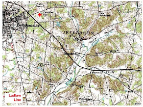 The Ludlow Line is just visible on the left side of the map, shooting into the county seat of Bellefontaine, pronounced 'Bell-'Fountain by the locals (and everyone in Dayton, too).
The cultural landscape is as interesting as the geological one. Nearby are the two Piatt Castles, built by a notable political family of 19th century Ohio, who relocated here from Cincinnati in the 1820s. The castles (large mansions) are from the 1860s and 1870s, though.
 Campbell Hill itself is not as impressive as the countryside to the south, being a large rise rather than a true hill or peak, yet one does have a slight feeling of the land dropping away to the the west; perhaps the horizon is a bit lower. This effect is more noticeable in the winter.
 Campbell Hill has a modern historic signifigance as a Cold War relic. The Air Force built a radar warning site here in the 1950s, complete with a military housing area. All that's left are the radar and radio towers, visible above, and some of the housing.
A few pix of the countryside in the vicinity of Zanesfield, in the center of the hill and valley country southeast of Campbell Hill.
 A suprising connection between this countryside to the Dayton scene is the annual Southwind Music Festival, held on the grounds of the Zane Shawnee Cavern, owned by a remnant band of the Shawnee (descendents of Indians who stayed behind when the tribes were relocated west). Southwind is a project of local music scene folks (check out the "freinds" section at the link) bringing bands one would ordinarily hear late at night in a downtown bar to a a sunny summer outdoors setting. This festival is part of the larger jam band/festival scene best exemplified by the Bonnaroo event down in Tennessee.
This country was long home to the native Americans. One of the last reservations in Ohio was the Shawnee/Seneca reservation between what is now Indian Lake and the Greenville Treaty line. The indians retained this land until the 1830s, when they were finally moved west.
Indian Lake itself is a major feature of the region. This lake is the headwaters of the Great Miami, but it's not a natural lake like the glacial lakes of Michigan and northern Indiana. Indian Lake was once a big swamp akin to the Scioto Marsh, but was turned into a resevoir in the 1830s and 40s to feed the Miami and Erie canal
 With the rise of free time and recreation the lake became a resort area in the 20th century, and still is popular with fishermen and as a vacation home site.
As was noted the difficulty in determining sources of the Scioto led two boundary surveys of the VMD. So the Scioto Marsh countryside north of Indian Lake is the "last of Virginia" in Ohio.
 The red line in the above map is the end of the Roberts Line and the blue line would have been Ludlows survey ending in the lower reaches of the Scioto Marsh.
The Last of Virigina: the end of the VMD survey at the headwaters of the Scioto, as expressed in field boundaries and country roads:
 The heart-shaped Scioto Marsh was rather large. It is all drained today, yet the rich black soil is still visible in aeriel photographs of freshly tilled fields, as one can see here. The Scioto has been channelized in this area, but one can still the contrast in the north-south orientation of the fields west and north of the river vs the angled field to the south, probably based on surveys run off the old Ludlow line or Greenville Treaty Line.
 The (drained) Scioto Marsh: flat as a board yet near the top of Ohio. The Scioto Marsh apparently warrants a historical marker, and it does have a history. The place was not typical wesern Ohio farm country, but relied heavily on hired hands imported from Appalachia, who organized and went on strike in 1934 (discussed in the old WPA Federal Writers Project Ohio Guide).

A modern book is out on the marsh: Unearthing the Land, The Story of Ohio's Scioto Marsh.
which discusses the strike, but also the natural history of the marsh and its subsequent draining and cultivation.
So, the Top of Ohio. Where the generic Midwest gets interesting. Perhaps even an example of a subltle American Heimat?
The Virginia Military District's boundary would be closed by surveying a line between the sources of the boundary rivers. Conceptually simple except that the Scioto was considerably longer, and its northern course turned west, extending past the source of the Little Miami.
 The first attempt to run a survey closing the VMD was by Israel Ludlow, platter of both Dayton and Cincinnati, and namesake of Ludlow Street in downtown Dayton. His survey was the Ludlow Line, and can still be traced through the modern landscape.
The lands of the VMD did not extend all the way north to the source of the Scioto at first. The Greenville Treaty Line of 1795 marked the end of US and state lands, because north of the line was "indian country". Aboriginal title would finally be extinguished north of the Greenville Treaty Line in the early 1800s, permitting this last piece of the VMD to be claimed and surveyed.
 At the time of the Ludlow survey the source of the Scioto was thought to be a large swampland called the Scioto Marsh. The discovery that the headwaters extended beyond the swamp led to a second survey, the Roberts Line. This survey ran at a sharper north by northwest angle, terminating north of what is today Indian Lake (but was then yet another swamp) and then via right angle to the Scioto headwaters.
The Roberts Line was accepted by the Federal government, but the Feds bought out the Viriginia claims between the two lines, resulting in the Ludlow Line remaining the boundary of the VMD south of the Greenville Treaty Line. North of the treaty line the Roberts boundary was used, as shown on the map below. Also shown is a modern map, demonstrating how these 18th century survey lines are still visible in the modern landscape, usually as country roads and fence lines. And that the irregular metes and bounds surveys generate erratic road patterns compared to the gridded landscape west of the Ludlow Line.
 The red cross marks Campbell Hill, at 1529 feet the highest point in Ohio. This is the "top of Ohio".
 The countryside around Campbell Hill is noticeably different, too. While the surrouning area is the flat Midwestern plain the vicinity of Campbell Hill, particularly to the east and south, is rather hilly, with wooded, steep slopes and flat valleys and bottoms. It almost looks like it was missed by the glaciers (like southwest Wisconisn), but this is not the case.
If one starts at Deeds Point in downtown Dayton and follows the Mad River north one will end up in these valleys, because this is the headwaters country of the Mad.
 The Ludlow Line is just visible on the left side of the map, shooting into the county seat of Bellefontaine, pronounced 'Bell-'Fountain by the locals (and everyone in Dayton, too).
The cultural landscape is as interesting as the geological one. Nearby
 Campbell Hill itself is not as impressive as the countryside to the south, being a large rise rather than a true hill or peak, yet one does have a slight feeling of the land dropping away to the the west; perhaps the horizon is a bit lower. This effect is more noticeable in the winter.
 Campbell Hill has a modern historic signifigance as a Cold War relic. The Air Force built a radar warning site here in the 1950s, complete with a military housing area. All that's left are the radar and radio towers, visible above, and some of the housing.
A few pix of the countryside in the vicinity of Zanesfield, in the center of the hill and valley country southeast of Campbell Hill.
 A suprising connection between this countryside to the Dayton scene is the annual Southwind Music Festival, held on the grounds of the Zane Shawnee Cavern, owned by a remnant band of the Shawnee (descendents of Indians who stayed behind when the tribes were relocated west). Southwind is a project of local music scene folks (check out the "freinds" section at the link) bringing bands one would ordinarily hear late at night in a downtown bar to a a sunny summer outdoors setting. This festival is part of the larger jam band/festival scene best exemplified by the Bonnaroo event down in Tennessee.
This country was long home to the native Americans. One of the last reservations in Ohio was the Shawnee/Seneca reservation between what is now Indian Lake and the Greenville Treaty line. The indians retained this land until the 1830s, when they were finally moved west.
Indian Lake itself is a major feature of the region. This lake is the headwaters of the Great Miami, but it's not a natural lake like the glacial lakes of Michigan and northern Indiana. Indian Lake was once a big swamp akin to the Scioto Marsh, but was turned into a resevoir in the 1830s and 40s to feed the Miami and Erie canal
 With the rise of free time and recreation the lake became a resort area in the 20th century, and still is popular with fishermen and as a vacation home site.
As was noted the difficulty in determining sources of the Scioto led two boundary surveys of the VMD. So the Scioto Marsh countryside north of Indian Lake is the "last of Virginia" in Ohio.
 The red line in the above map is the end of the Roberts Line and the blue line would have been Ludlows survey ending in the lower reaches of the Scioto Marsh.
The Last of Virigina: the end of the VMD survey at the headwaters of the Scioto, as expressed in field boundaries and country roads:
 The heart-shaped Scioto Marsh was rather large. It is all drained today, yet the rich black soil is still visible in aeriel photographs of freshly tilled fields, as one can see here. The Scioto has been channelized in this area, but one can still the contrast in the north-south orientation of the fields west and north of the river vs the angled field to the south, probably based on surveys run off the old Ludlow line or Greenville Treaty Line.
 The (drained) Scioto Marsh: flat as a board yet near the top of Ohio. The Scioto Marsh apparently warrants a historical marker, and it does have a history. The place was not typical wesern Ohio farm country, but relied heavily on hired hands imported from Appalachia, who organized and went on strike in 1934 (discussed in the old WPA Federal Writers Project Ohio Guide).
A modern book is out on the marsh: Unearthing the Land, The Story of Ohio's Scioto Marsh.
which discusses the strike, but also the natural history of the marsh and its subsequent draining and cultivation.
So, the Top of Ohio. Where the generic Midwest gets interesting. Perhaps even an example of a subltle American Heimat?