Following up on the Newcom Manor post, here is an aerial showing that building, Monument Avenue (Dayton’s 19th Century social row), and the Soldiers Monument, which is a Civil Ware memorial. The Monument was erected in 1884, after a lengthy fundraising campaign, which included repeat performances of the “The Drummer Boy of Shiloh” at Turner Opera House (today’s Victoria).
Lichtenberger’s caption :
Excavation for the foundation of the Soldiers Monument at Main Street bridge began on September 19, 1883 and ended on November 22, 1883. Granite for the monument was quarried at Hollowell, Maine. The first carloads arrived on April 19, 1884. The statue of the Union soldier was cut out of white marble in Carrars (sic), Italy. It arrived in Dayton in June 1884. George W. Fair of Dayton was the model for the statue. On Wednesday, July 30, a G. A. R. parade was held. It was estimated that 10,000 persons were on the streets of Dayton that day. The monument was unveiled the next day, Thursday July 31st. It was 85 feet high with the statue accounting for 11 l/2 feet. This photograph, which was taken in 1889, also shows the old iron bridge and the Hose Company George Fair was a Dayton bricklayer, living most of his life in the neighborhoods west of downtown, between downtown & the Great Miami (now the site of Sinclair and the county government buildings)
After the Monument was dedicated Water Street was renamed Monument Avenue.
With the advent of the automobile the Monument became a bottleneck (back when Main Street had a lot of traffic), so it was relocated in 1948, to a park area across the river. (pix from Dayton, the Gem City). Good view of the Biltmore Hotel here, and traffic coming across the Main Street Bridge. The Monument was a gateway feature for downtown.
And there it stood, pretty much forgotten, until the late 1980s, when an urban design plan for downtown proposed the relocation back to Main Street, as part of a larger streetscape improvement for Main (more trees and benches and such). This time, the Monument was sited mid block between Monument Avenue and First Street. The Monument was rededicated in 1991 at the new site, just a few yards from it’s original location.
The design was to site the Monument in a traffic island, necking down traffic to two lanes as it passed the Monument, but broadening again after passing the island. The design is actually a good traffic-calming feature, permitting people to cross to the island, between a row of bollards, where there is some seating and a small plaza south of the Monument.
The raised planting beds provides a sheltered space in the middle of Main, so as to admire the monument and look at the surrounding streetscape.
A view of the Monument and island, looking north. As part of the project the statue of Private Fair was found to be badly damaged by acid rain, and was remade as a bronze casting by a Cincinnati restoration firm The bollards marking the break in the raised planting beds, and dip in the curb, inviting one to cross the street
The little plaza inside the island, with the planting bed edges developed as benches. This is a neat space, actually fairly sheltered from traffic and somewhat intimate in scale, yet in the very heart of the city.
At the end of the space is one of those pay-telescopes if one wants to look into the windows of the surrounding high-rises. A pretty good view south down main (and one of Dayton’s trolleybuses is visible; since they don’t make them in the US, RTA got new ones from Skoda in the Czech Republic).
An interesting feature is that the planting beds are broke here as well, but the low iron fence prevents walking across the sreet (and a good thing, too, as traffic would start to accelerate at this point due to lanes starting to widen and the venturi effect of the island)
Looking back one has a great view of the Monument, flanked by flagpoles and decorative light globes, reminiscent of City Beautiful era urban design. From further back on Main, the Monument terminates the northward vista up the street, creating a sort of quasi-baroque or neoclassical urban design concept (boulevard vista, termnatd by a monument or arch or public building).
And looking back across Main at the ground floor of the Biltmore., with the street trees and widened sidewalk. The street was slightly widened at the entrance to the Biltmore to permit passenger loading and unloading.
This is a deceptively simple design, but it is quite successful in creating a mix of monumentality and intimacy, as well as being quite successful as a traffic calming feature.
One of the better urban design features in a mostly utilitarian city, and an illustration on how small design moves can still be quality moves, and have a big impact on a cityscape.
Sunday, August 24, 2008
The Monument: Good Urban Design
Sunday, January 27, 2008
The Olmstead Landscape System
The DDN reports today on a landscape restoration plan for Hills & Dales.
A $4 million restoration project at the 297-acre Hills and Dales MetroPark in Kettering aims to recreate the look of the landscape when the park was a gift from John Patterson, co-founder of National Cash Register.
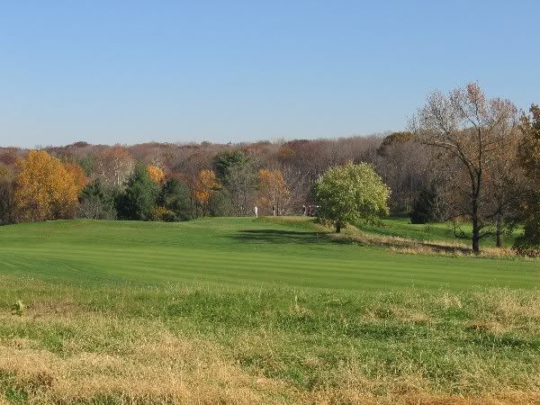
Nowadays the “park” seems like merely a big golf course with landscaped fringes. The original idea was much more ambitious.
Patterson, along with fellow industrialiss Deeds and Kettering contracted with the Olmstead firm of Boston, Mass to landscape their adjoining properties.
The intention apparently was to create an interlocking landscape system in the hill country west of Far Hills, extending from the Dayton Country Club to Rahn & Alex-Bell Roads, with a parkway (Southern Boulevard) as a connecting feature. Adjacent subdivisions estates and parks (Houk Stream)may also have designed by the Olmstead firm.
This systemic approach was akin the previous Olmstead work, such as the Emerald Necklace in Boston (though that was an urban scheme and this one rural/suburban
 The northern part was developed as Hills & Dales Park and parts of Oakwood & Kettering.
 The southern part was never completely developed, though parts became the NCR and Moraine Country Clubs and the Deeds estate.
 The interesting thing about Hills & Dales was that it was originally twice its current size, extending south of Dorothy Land. And there were little side-parkways that connected the main body of the park to Far Hills Avenue.
 Only the northern part was the gifted to the city. The southern part was later subdivided for housing.
An interesting feature was that there was a branch of the interurban line running to the park, and extending down Southern Boulevard (possibly why Southern is so wide). This is shown in the above map in red.
The idea was to improve access from the city, but with heavy auto usee cars were banned, and the park was only accessible via train.
Subsequent developement disrupted the system, and it was never completed. Enough survives, though, to give Dayton a greenbelt of estates, parks, and golf courses extending south of the city.
Vignettes from the Olmstead landscape system:


Saturday, December 29, 2007
The Oldest City House in Dayton
What is the oldest house in Dayton on its original location?
It seems it's an old farmhouse on the northern edge of the Westwood neighborhood, dating from the very early 1800s. There may be other old farmhouse out in the neighborhoods (according to the auditors records theres is one in Ohmer Park from the 1840s)
But what's the oldest city house? The Newcom Tavern has been relocated, and an old house from the 1820s was recently torn down for the new Avis office.
Local tradition says that the Clegg House is the oldest house, dating from 1827 or 28. Looking at the facade on First Street one sees an impressive cube house with nice limestone facade with rusticated base and an ionic pilasters. I would date this later than the 1820s based visual evidence in the Lutzenberger collection and extant houses in the older parts of the Oregon. To the rear, however, one sees these appendages to the Clegg House. What if one of these, particularly the two story one, was not an appendage but a frestanding house at one time? One can see some modifications (like the horizontal band windows) and what looks like half wood/half brick construction.
 However, going around to the front one does see a facade that looks "old", due to the roof line running parallel to the street and the zero lot line construction.
 Comparing this to some of the oldest Oregon houses, one sees the window arrangement and central "gap" matches the facades of some early double houses, and there is a central chimney that might have been shared by two sides of the house. The door is also on the end, like some early doubles.
 A typological analyses showing how this might have been either a modified double, or a single borrowing the typology of a double.
So, the oldest city house (not farm house) in Dayton could well be the "Clegg House", not the big house on First but the rear "wing".
Friday, December 7, 2007
Rephotography in The Oregon
Enough of the dismal science. Here is a Friday fun thread. Some rephotography sets from The Oregon. 


If you have any questions, post them at the comments and I will reply when I get back from Kentucky next week (and to enlarge, just click on the image)
Riding the Poverty Train in Montgomery County
I understand that the Columbus Dispatch series is about the core cities of Ohio, but it perpetuates the mind-set that city and suburb are seperate, which is a common belief in the Dayton area.
And in many ways Dayton and suburban Montgomery County are the two solitudes.
But in one way, economics, they are not. Dayton is one metropolitian area and one economic market. So it's interesting to see how the long term economic decline of the region is not confined to Dayton city.
I find this map a very good demonstration of this. It maps the change in poverty over the 1970-2000 time frame, the period when the Dayton metro area stopped growing and saw some big job losses. It shows which census tracts saw an increase or decrease in poverty, even if it meant the actual poverty rate was very low.  ...in other words, tracts in, say, Kettering, may have moved from 0% to .05% poverty, a very small amount, but still an uptick.
What the above map demonstrates was that poverty was incerasing across Montgomery County, not just in Dayton, even in outer suburbs like Vandalia, Englewood, Fairborn, Huber Heights, and so forth. Then this chart (based on County Business Patterns data), showing the decline in manufacturing employment in Montgomery County.
The map does not show the big drop at the start of the 1970s when NCR shut down manufacturing here. I would love to find the 1970 number for the county, but one can still see the long term slide down, even starting at 1977.  The reason I harp on manufacturing is that this sector had three things:
1. A lot of jobs for unskilled workers and people without college degrees.
2. Jobs that paid a living wage.
3. Jobs that had health benefits and pensions and seniority due to unionization.
Take all this away and one can see how median income could decline, and that at the bottom of the job market more would be forced into poverty.
So, perhaps one is seeing is the local development of a national phenomena, the transformation of the USA into a two-class economy or society by cutting blue and pink collar workers out of the middle class via the reduction in living wage jobs.
What's also interesting is that a Dayton region with widespread prosperity is within living memory of the older generation. Seeing this go away may account for the local pessimism and negativity.
Sunday, November 25, 2007
The Fall of Main Street, Block by Block
 An investigation of Main Street and how it got that way. Block by Block. Looking at Main Street as a street (per Jane Jacobs). I look at street front retail, storefront business that has some public interaction (no professional offices or beauty schools), but things like stores, loan companys, restaurants, theatere, and so forth.
No arcade or lobby business (as much as possible)...just things that face the street, as a gauge on how active or lively the street is
Here is the rough cut, where I graph the businesses. I also lay in things that affect the retail environment, particularly the suburban competition.  Then a look block by block, from Monument to the railroad embankment.
  Then looking in some detail at the blocks. I note physical changes (like the opening of a larger store) that impacts the count. First, the two blocks north of Third:
 Next, the two blocks south of Third:
 Note that some of the largest drops are from physcial alterations driving removals of buildings, reducing the number of storefronts. This implys that, though retail was declining, some urban renewal and new construction decisions also had an impact, and accelerated the decline.
 I will take a look at a the retail mix next.
For a more in-depth treatment follow this link:
The Decline and Fall of Main Street
