The DBJ has a great little article on some good economic news:
Dayton a Hotbed for High Growth Firms.
...which is a report on a Small Businesss Administration study on "high impact" firms. These are firms whos sales have doubled and also had a steady growth in payroll.
These are not necessarily start-ups (average age of a firm is 25 years old), and the firms can be any size. Apparently most of the firms in the SBA sudy are smaller, just because there are more smaller business.
Here is the SBA blurb on the study:
"According to a study, High-Impact Firms: Gazelles Revisited, “high-impact” firms create America’s new jobs and growth. Distributed across all industries, high-impact firms account for almost all employment and revenue growth in the economy, the study concludes."
For a link to the SBA page and the articles click here:
Saturday, July 26, 2008
High Impact/High Growth Business in Dayton
Sector 725: Washington Townships Brave New World
...though not so new as its 25 or more years old by now.
Revisting this map of weak GOP concentrations...
....and mapping out the cluster of weak precincts along OH 725, Miamisburg-Centerville Road, one see's that this is what has occasionally been refered to as "downtown Washington Township", a landscape of light industry, offices, strip malls, and eating and drinking places. The area also has a concentration of multi-family houisng of various types. Interesting it also has two liberal congregations, the Unitarian/Universalist churhc and a church affliated with the United Church of Christ (Obama's old denomination) headed by a gay minister.
This is interesting because The Big Sort discusses religion quite a bit, explaining how people are sorting out into homogenous congregations. The author notes that while this is more on the evangelical side, he does give an example of this happening on the more "left" side, too, with a Methodist church in Austin, TX. In this area we have two congregations as examples of that.
Using census block maps, which are limited to some basic demographic data (and also show Centerville), one can see how this area differs from the unicorporated areas to the north and south, in this case with homeownership. If the detail would have been fine enough one could also map out multifamily, which would have shown condominiums as well as rentals. This demographic data isnt that strong, but there are few concentrations of latinos and blacks in the area. Perhaps one could have run the numbers for asians, as two Indian grocerys are within the weak GOP cluster, perhaps indicating a bit more cultural diversity than one would expect.
 Beyond race and ethnicty it would be intriguing to look at family compostion, preveleance of same -sex households and couples, income, etc. Household size is about as detailed as one can get with block maps available at the census website.
 This map implies more singles and couples in the weak GOP area, perhaps indicating younger unmarried people and differing family compostion from the overwhelmingly GOP southeast and northwest quadrants.
Years ago, it seems a trade-off was made in Washington Township.
The township fathers had to decide if they wanted to keep their family-oriented single family home suburbia, or permit "the others" to come in via apartments, condominiums, and things like more shopping, industry, and retail. The trade off was increased property tax revenue vs socioeconomic diveristy.
Apparently the zoning apporach was to segregate non-single family uses along OH 725 between Centerville and the township line, creating a little bit of "the city" (the dispersed suburban form we know as "edge city") in the suburbs. This happened elsewhere in the township, but not as intense as at the OH 725 corridor.
Apparently this trade-off had political consequences as it did draw more Democrat leaners into the township. Given the intenstity of development here as well as in adjacent Miami Township this has become an employment center, so one will see more people living and working in close proximity, as well as the working poor commuting in on mass transit or living in what cheaper rentals that can be found, to be close to their service sector work.
If it comes to pass that the urban poor and suburban upper middle class trade places, this is the area were the urban poor will first move into.
So the reality in "Sector 725" (sounds a bit like dystopian sci-fi, no?) does not conform totally to the suburban cul-de-sac stereotype, either politically, sociologically, or in physical form.
It certainly is atypical enough compared to the rest of Washington Township to be considered a different place altogether.
Deep Red in Washington Township
Unlike Oakwood, Washington Township is a better example of Bill Bishop's Big Sort theory, as precincts in the unincopororated parts of the township are much more likely to provide landslide victorys, in this case for the GOP.
In fact the point spread in Washington Township precincts exceed those of the Republican precincts of Oakwood, delivering, in some cases, majorities in excess of 35% to the GOP.
A good example is the Senate race in 2006. Nearly the entire northwest and southwest quadrants of the township went for the Republican by over 20%. In fact two of the southwest quadrant precincts where the top GOP precincts in the county for this race, delivering 71% and 72% of the vote to the GOP.
(again the % here is the difference in % between Democrat and Republican, to illustrate political polarization)
About the only areas in the unincorporated parts of the township that had a weak GOP vote were the OH 725 corridor, Sheehan Road area, and Nantucket Landing condo complex. Other weaker areas (but still pretty solid GOP) were Red Coach Farm (?) off Rahn, and some older areas also off Rahn and Whipp, east of Mad River. And that odd little Precinct V, north of Spring Valley. Apparenlty township votes found the GOP candidate that year much preferable to the Democrat.
Going to the bottom of the ticket, for County Auditor in 2006, similar pattern, though the GOP vote here weakens , perhaps indicating name recognition and the affects of incumbency. In this election the Dem actually won six precincts, and brought the margin to below 5% for 3 more. Again, one can detect a weakness in the OH 725 area west of Centerville. For the Governors race I only mapped out the landslide precincts (where the GOP candidate beat the Democrat by 20% or more) and areas where the GOP was weak to investigate if a political neighborhoods were forming.
One can see the Democrat was much more competetive here, coming within 5% in three precincts, running at a tie in two precincts, and carrying four more. The Republican did better here than Oakwood, with six landslide precinct, including, at 62% of the vote, the top GOP precinct in the county for this race. Based on the above one can see certain precincts where the GOP is somewhat weak: Red Coach Farm (which, suprisingly, the Democrats occasionaly carry) and a plat in the Woodbourne area in northern Washington Twp, the OH 725 area, Nantucket Landing, and Sheehan Road. The OH 725 corridor, south of I-675, is particularly interesting given that precincts here will go Democrat on occasion.
The Republicans have very strong showing across the unicorporated parts of the township, but maybe moreso in the southern half (basically Waterbury Woods subdivision), and especially the southeastern quarter south of Spring Valley Pike, with three more or less consistent landslide precincts Washington Township is perhaps the most Republican community in Montgomery County, with precincts besting even the trad rural areas in western Montgomery county. Yet even here one can see evidence of political neighborhoods, clusters of precincts that deviate from the expected pattern of polarization, where the opposing party comes close, and sometimes wins.
Thursday, July 24, 2008
Oakwood in Red & Blue
The Big Sort, a somewhat new political book, has received some notice in unusual places. Dayton Most Metro parented a thread on it, which died a quick death, and the Louisville Courier-Journal did a somewhat favorable review in their Saturday book page.
The premise is that Americans are sorting themselves out into homogeneous communities, and this has political implications.
The concept isn’t that new. In the mid 1970s (1974) Herbert Gans introduced the notion of taste cultures as a more nuanced approach to socioeconomic status and class. Between 1976 and 1978 the somewhat similar PRIZM market segmentation concept was developed. Populations were refined into market segments, called clusters, and the clusters where mapped (by zip code and media market), so there was a geographic turn to clustering. A related concept developed around the same time (1978) was the VALS (Values/Attitudes/Lifestyles) which was somewhat less geographical .
The PRIZM approach was popularized via an 1988 book, “The Clustering of America”.
The Big Sort shows how politics reflects this geographic clustering of like-minded folks. One of the points of the book is that beyond the red/blue divide, political geography at a more granular scale reveals counties and cities that become more polarized over time, becoming more and more Democrat or Republican. The author uses the increasing number of “landslide counties” to measure polarization. If the Democrat (or Republican) vote was 20% over the vote for the opposing party (ie a “landslide” win) the county was deemed polarized.
For Montgomery County, in the 2000 & 2004 presidential elections, the vote was nearly exactly 50/50, with the GOP making a slight increase in 2004, so not polarized at the county level. Below that things get more interesting.
The Big Sort in Oakwood.
Oakwood is the case study as it is small enough to work with (and had a precinct map on the city website), and also due to the local stereotypes about the suburb as a sort of stuffy, conservative, blue-blood kind of place . This would imply a sort of conservative Republicanism.
The reality is more nuanced.
The following chart shows the Oakwood precincts by election in 2006. From left to right the Senate race, Governor and statewide offices, followed by two county commissioner races and a county auditors race. The blue-Dem/red-GOP graphic convention is used to show which party carried a precinct. The number shows the point spread for the precinct. In other words it shows by how many % points the Dem or GOP candidate carried the precinct (negative number shows a GOP win).
For example, for precinct V, Senate race, red color indicates the Republican carried the precinct, and the number shows the Republican won it by 26.5 percent points over the Democrat. Since the interest here is in political polarization….”landslide precincts”…the degree of partisan support is of interest , as well as how frequently a precinct goes Dem or GOP.
The bottom bar shows which party won the suburb by office, and just by this Oakwood is pretty Republican; the GOP carried nearly all the offices listed here
Oakwood Political Neighborhoods
Mapping the results of the chart by precinct, one can easily see how Oakwood divides up into ‘political neighborhoods’, with Far Hills Avenue being the obvious divide. Far Hills has long been a social divide, with “West of Far Hills” being the estate district. Yet it’s interesting to see this also map out politically.
Things get more interesting in northern Oakwood, where the Shantz Park area is swing precinct splitting its vote between Dems and Republicans. There is also a strong GOP presence in precinct B, east of Far Hills.
Let’s look at the Senate and Governors race to see if polarization is evident.
For the Senate race the GOP did well. Four precincts in northern Oakwood polarized towards the GOP, including a leaning GOP precinct. The Dem precincts in southeast Oakwood went Dem, but with tight point spread For the governor’s races, the GOP apparently had a weak candidate as he didn’t carry any GOP precinct over 20%, and lost two of the swing precincts. In contrast two of the Democratic leaning precincts polarized, with point spreads 20% or over in favor of the Dem candidate.
 Revisiting the chart, and looking at landslide wins one can see the areas that are GOP tend to deliver more landslides while the Democratic areas are less likely too. Precinct O seems to be the most reliable Democratic-leaning precinct.
Without having multiyear comparisons one can’t say if there is a Democratic or Republican trend in Oakwood. Given the suburbs’ reputation and the evidence of mostly Democratic and swing precincts, one can infer that this suburb, or parts of it, is more Democrat than the stereotype. What’s also evident is that the suburb isn’t that polarized. The point spread depends on the office and candidate, and there is considerable ticket splitting in at least two precincts.
Next we will look at a much more politically polarized suburb; the unincorporated parts of Washington Township
Saturday, July 19, 2008
Harry Weese in Dayton
Southwest Ohio has three Harry Weese buildings of note. The Formica Building and Arcade (which included the old Contemporary Art Center) in Cincinnati, the Middletown City Hall, and this skyscraper in Dayton, orginally the First National Bank: I think it opened in 1970, and never recieved much attention due to it's "off Main" location and being overshadowed by the taller (but less coherent) Kettering Tower, which opened around the same time.
Though at first glance this appears to be an utterly banal, functionalist design, I will show that on closer observation there are some sublte design moves going on here.
This building comes from a time when Weese was landing high rise commissionsm, and shortly after his DC Metro commission. It was contemporary with his better known Time/Life Building, a Cor-Ten & mirror glass masterpiece in Chicago's Streeterville. This Dayton tower shared the minimalist aesthetic, but was executed in concrete instead of steel.
Though not evident at first glance this Dayton tower is a very contextual building, and has subtle facade development. At first glance one can see the building top is pretty clearly set apart by the blank panels and larger bay size. There is similar articulation in the first three floors. So right off one sees the classical tripartite division of base, shaft, and capital or top.
The first contextual move is to site the building so it faces the little plaza in front of the Federal Building, and pulling the building back from the street, as well as slightly raising it to create a base or plinth. Today this space appears to be developed as a sidewalk dining area, but it was probably intended as a somewhat formal entrance to the banking area (maybe, not sure where the banking hall was here). Since the building is oriented north-south, a void was left facing 2nd Street. This was filled by a three story annex and plaza (over underground parking). Here one can see how Weese developed the first three floors at taller bay height, to match the annex and create a better presence at street level.
 Setting the annex back is a simple move that has a big effect, as it sets off the tower, causing it to read better. But, as a minimalist high modern design the tower does not work with the street the way the next door Hulman Building does, as there is no entry directly off 2nd.
Instead the design does an off-center entry, typical of modernism, which often eschewed symmetric composition. In this case the entrance is where the annex meets the tower, setting the doors somewhat within the building, and using the paving pattern to "point" to the entrance by laying the paver bricks longways between concrete divider pavement. The row of small ornamental trees also articulate entry, leading the eye into the building. 
Setting the entry up this way also activates the plaza by forcing pedestrians to use the space. Yet the north exposure means this place will always be somewhat shaded.
Getting closer the design uses a play of light, shade, and transparency to as part of the entry sequence. To enter the building one is walking in the most shaded part of the plaza, along the annex. But the transparancey of the window walls and set back of the doors reveal the light and green of the Federal Building plaza, which acts as a point of visual interest, drawing ones eye into and through the building.
This is almost akin to the Japanese landscape design concept of shakkei, or the borrowed view.
Unfortunaly no images of the interior, which would have been altered from Weeses; orginal design by now (except for the location of the elevator core).
This building is the location of the new Sidebar cocktail lounge, and one hopes the interior design of the place lives up to the architecture. If the intent is to create an atmosphere of urban moderinist elegance and style, a good building for it.
For more on Harry Weese:
Herbert Muschamp's obit in the New York Times:
Harry Weese, 83, Designer of Metro System in Washington
The Art Institute of Chicago's oral history project interview:
Harry Mohr Weese
Dayton's Oldest Gay Bar
Daytonology was visiting Sacramento during Pride Month, so a belated Gay Pride thread for Dayton, doing some Gay History (and, yes, there is such a thing)
Before Gay Bars: The Levee
I don’t know if there were saloons or halls that catered to gays back before prohibition, but I do know that in the police records there was one or two arrests per year for ‘impersonating a female”. Unfortunately the records don’t list particulars for those cases.
I do suspect, and this is just speculation, that the levee was a place of assignation, a cruising spot. I say this because the levee was the cruising spot in modern times, but not actually on the levee, which makes me think that this is a name carried down from an earlier location that’s long gone.
Perhaps this location:
…which appears in the New Dayton Illustrated
This would be the levee wrapping around downtown from Wilkinson Street to the west and south down to 4th or 5th.
Outdoor cruising spots have been pretty common in gay history: famous ones were Hempstead Heath in London, the Siegesaule (Victory Column) in the Berlin Tiergarten, and the square in front of the Bolshoi Theatre in Moscow. For the US it used to be ‘the rocks” on Lake Michigan and Bughouse Square in Chicago and Pershing Square in LA.
In Ohio pioneer gay writer Edmund White mentions the old, pre-urban renewal Fountain Square as gay cruising spot and pick-up place in his early semi-autobigoraphical fiction
And for Dayton, it might have been this tree shaded promenade, which might have been more a meeting place rather than a sex space. Another thing that leads me to think this was the orginal Levee is that nearby Robert Boulevard was a place of residence for gay men. Older gay men tell me their first sexual encounters were sometimes in these old houses, by then turned into apartments
 The Levee was a long-lasting institution for those wanting male/male sex. It even made it to the internet era in the 1990s as there was the Levee BBS as an early online meeting & hook-up place for Datyon gay men
Another cruising spot was Cooper Park. No supposition here as there is documenation of tis as a place of assignation.
Cooper Park appeared in a collection of coming-out stories, where one of his authors mentioned his first encounter was arranged here, with a local educator (either a principle or school board member). The landscaping in these pix is somewhat sparse, but by the 1920s and 30s it was probably much more lush
 City of Bachelors: Single Men Downtown
Cooper Park might have been equivilant to Bughouse Square and Pershing Square as it (and the levee) was in an area of rooming houses and small apartments and cheap hotels, the other side of downtown Dayton.
Unattached men of whatever sexual orientation where considered deviant, as discussed in Todd DePastino’s “Citizen Hobo (which discusses the moralistic tut-tutting about “Hotel Society” as well as the intinerant world). The book also has a section on “Hobosexuality”, discussing how this single society gave some cover for homosexuals.
A collection of character studies on Chicagos’ “Hobohemia” mentions gay, transvestite and lesbian establishments as part of Chicago’s Towertown, near Bughouse Square.
One can also see the SRO/roomer world as the gay habitat in John Rechy’s City of Night, recounting his days as an itinerant hustler.
For Dayton, the 1933 housing study helpfully identifies Dayton’s “Rooming House District” as the “1st Ward”’ AKA downtown and environs. Perhaps Dayton’s first "gayborhood (though it was shared by a lot of other folks). What’s remarkable about this map is the concentrations, not mention it may not be counting one room and studio apartments, which would up the single population even further.
A close-up with some references. Note, though, that a lot of these roomers were single woman, as there was a big rooming house or hotel for single Catholic country girls come to work in the city, in that quadrant northwest of Main Street. But there were a lot of apartments and perhaps residential hotels downtown. The most famous was the Arcade, but there were others, like these two on the Courthouse Square block (Atlas Hotel and Ratterman Apartments).
 One can easily see this world of downtown apartments and single room occupancies giving cover to a gay demimonde.
The Oldest Gay Bar
Looking at a map of the block that had the Atlas Hotel and Ratterman Apartments. The buildings are on the lower left hand corner. And, on this same block was Dayton’s first gay bar, 24 W Second Street. The Latin Lounge, on the ground floor of a parking garage (click on the image to enlarge). There may have been other post-Prohibition places, but this is the first one old-timers that I’ve talked to remember.
From what I’ve been told this place wasn’t gay until later at night, which would parallel an old-school approach to socializing and meeting. A bar or restaurant/bar would have a predominantly straight clientele, but as the evening wore on the straight folk would finish up their dinners or drinking and go home, and gays would slowly filter in until the establishment was predominantly gay by late evening and closing. The old Bungalow Restaurant on Mill Street in downtown Lexington used to operate this way.
The Latin Lounge opened in the early 1950s, say 1952 or 53. In the early 1960s, say 1961, it changed names to The Stage Door Musical Bar. “Musical” was an old school coded way of referring to one as gay…as in “He’s musical”. Old gay slang…the lost language of queens. But the yellow pages of 1966-67 does list it as having live music.
The name change happened after a brutal murder or gay bashing associated with a Latin Lounge pick-up gone wrong. There was an earlier Stage Door in Dayton, but it was in the Mayfair Burlesque building, and as far as I know has no relation to this name change.
The Stage Door remained on 2nd until the early 1970s, when urban renewal demolition for Courthouse Square forced the location to change to Jefferson Street (1973), where it remains today.
Dayton’s Second Gay Bar
The well-remembered but short-lived “Club Tai Tae” (the city directories call it “a cocktail lounge”) shared the second floor of the Victoria with the Schwartz School of Dance. You can tell where the place was by the porthole windows: (image from the unfortunatly out-of-print Dayton Sketchbook, which was one of the better books on the city)
The odd name was because this was a Korean Karate studio before it became a bar, and I guess the owner decided to keep the name as cover or because it sounded exotic, like a tiki bar.
The place was a piano bar, and the piano player, Harry, was also the doorman at the Stage Door in later years. When Harry passed his funereal was at the local Metropolitan Community Church (a GLBT-oriented church) and was a sort of landmark event.
The Third Oldest Gay Bar
This being Dayton building demolition rears its ugly head in any story, and it does here, as The Martinque, Dayton’s third oldest gay bar was torn down, perhaps twice!
The Martinique started out as a cocktail lounge on Salem Avenue, between the bridge and Grand Avenue, opening in 1967. Presumably it served the singles who were living in the new apartments buildings in Grafton Hill.
And perhaps those buildings attracted a gay population, too. There was an ownership change in 1970 or 71, and after that the place turned gay. Eventually it became Dayton’s lesbian bar (the first?) until being closed and torn down in the early 1990s. It was in a converted old house when I moved here, but I am not sure if that was the original location.
The Oldest Gay Bar Today
When the Stage Door relocated to Jefferson it moved to the building on the left, with an expansion in the 1980s to the building to the right. So there are really two buildings and two bars here. The first, older bar is usually closed, but open on weekends if there is a big crowd or special event.
Also, when the bar relocate it apparently retained the "Muscial Bar" listing in the phone book, too. Reportedly it was a stop-over for traveling entertainers who were either gay or gay freindly, among them Betty White, who supposedly gave a little impromtu concert here
The Stage Door is repositioning the original bar as sort of a Country/Western place, but at the back of the bar in this little alcove are two marionettes, reminders of the theatrical connections of the place.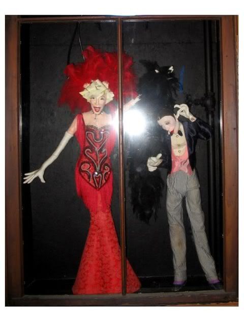
Monday, July 14, 2008
Montgomery County In Foreclosure: Graphing the Subprime Crisis
Esrati had an interesting post about problems with banks maintaining their properties (as well as making a tongue-in cheek-suggestion that I map this).
Instead of mapping, which requires things I don't have, namely GIS knowledge and access to the Auditors database, here are some quick charts from the online query tool at the County Auditors website. These track the growth of the foreclosure crisis in Montgomery County by tax year, based on number of holdings of various entities.
First, looking at Deutsche Bank, which was mentioned in the article at Esrati. Pretty clear how DB is owning more and more parcels (the unit of measure at the Auditors site) as the crisis builds, but appears to have started to plateau.
Next is Fannie Mae, since it's in the news. This institution had an impressive jump in holdings in 2005, and is still holding the bag on quite a few properties in Montgomery County
Next, HUD. Presumably HUD is holding some foreclosures, too. So what happens to these properties? The banks want to get rid of them, and there are buyers. One is locally based Performance Home Buyers LLC, which had an interesting article in the Dayton Business Journal back in 2004. They buy houses from distressed owners, but also foreclosed properties from banks, as per this excerpt:
"Wherever there are blue-collared working neighborhoods, that's where we are," Hawkins said. "We're rehabbing the customer's credit as well as the properties. We're trying to bring the neighborhoods up. It improves our collateral."
Performance looks for homes in a distressed situation, meaning they are likely to be purchased from a bank following a foreclosure, said Randall Porter, Performance managing member.
Here is their growth (they started in 2000 I think) …they also buy from estates, according to the article. So if your Ma or Pa die and you can’t sell the house they will buy it from you. This sounds sort of macabre, but they are recycling the property back into the housing market, which is a good thing. An alternative to boarding up and demolition.
What’s noticeable is that there isn’t much growth in their holdings after the 2004 & 2005 peaks, which could mean they have as much property as they could handle (I am not familiar with the company so would appreciate any lurkers to provide some intel).
Finally, the largest owner in Dayton is the City of Dayton. These properties could be a lot of different things, not just houses. They could also be vacant lots. What’s interesting, compared to the other graphs, is how stable this pool of property is. The Auditors database, limited as it is, can be of good use if one is interested in neglected properties, to find out who the owner of record is. Since one can sort by street address one could build a picture of what’s going on in a particular neighborhood in terms of ownership, and even track trends since the database goes back to 1999,
